")
And which developments should solve this problem in the near future
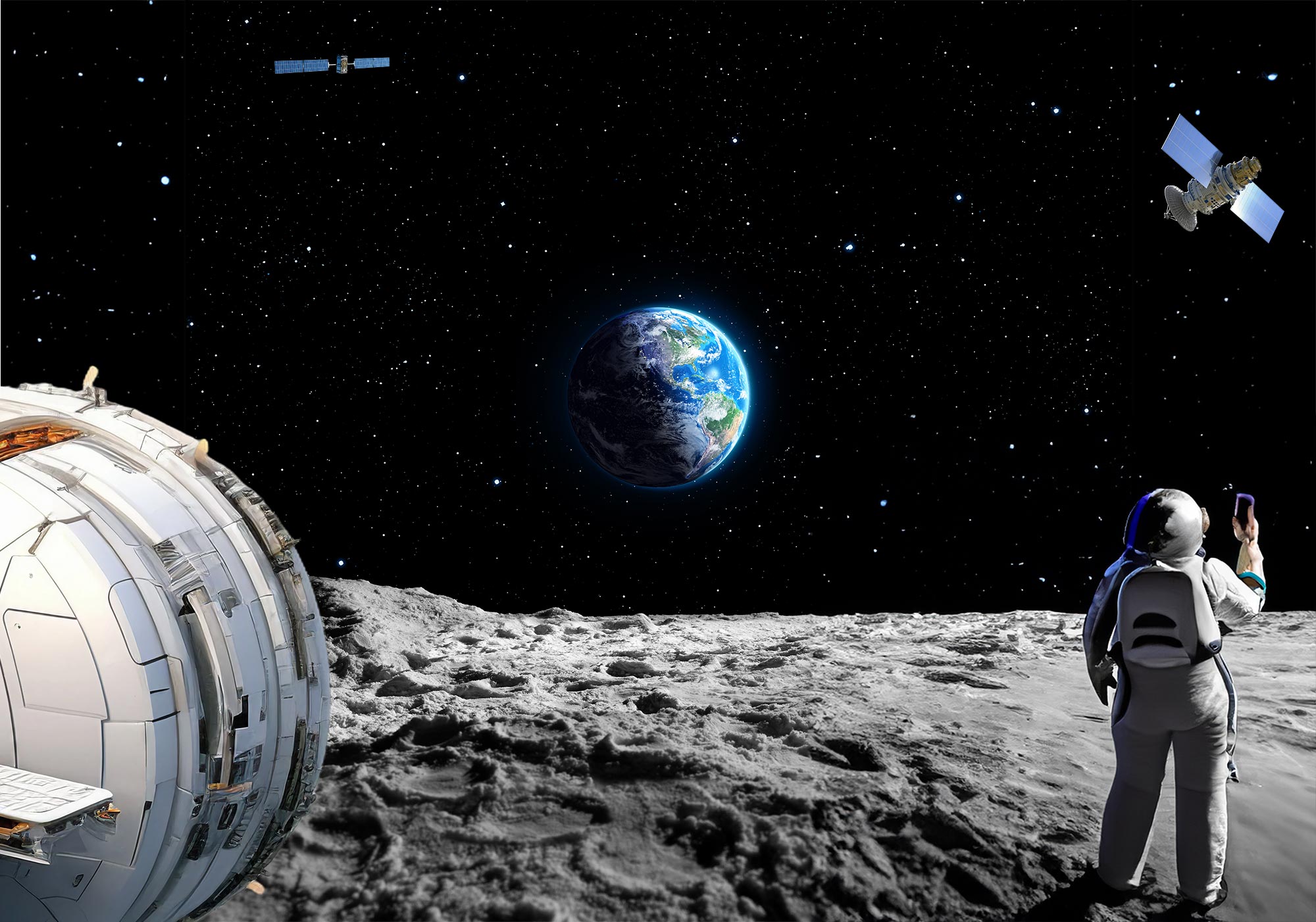
After more than half a century, humans return to the moon. This time with the intention of staying to explore and use the moon. NASA and ESA are therefore working on the definition and implementation of LunaNet, a network of different systems for time, communication and navigation to provide people and machines on and around the moon with a reliable time, internet connection and the most accurate position and route guidance possible.
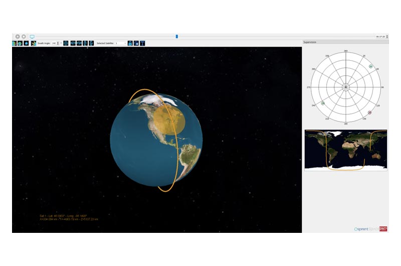
Sending navigation devices into space for functional testing is not really an option. The tests would be very expensive, difficult to control or repeat and a safety risk, not to mention the impact on the environment. The alternative to qualifying lunar navigation systems for use in space is simulation. The system to be tested is actually in the laboratory, but by supplying it with calculated signals it is supposedly in space and its functionality can be tested. The simulator must be able to reproduce reality in every detail and incorporate programmable difficulties for the device in the test. The simulation of the lunar environment presents particular challenges for PNT systems (PNT = Positioning, Navigation and Time).
Moonmissions
Six of the 17 Apollo missions of the US space agency NASA brought a total of 12 astronauts to the moon between 1969 and 1972. In addition to the Americans, Russia, China, India and Japan have also carried out missions to the moon, with the Apollo missions being the last human landings on the moon to date. There have been manned flights around the moon, unmanned landers (stationary systems with research tasks), rovers (unmanned vehicles) or orbiters - satellites that collect observations from a lunar orbit and send them to ground stations on Earth.
The aim of the lunar missions is to analyze the surface and resources of the moon and to use it in the future, mainly as a basis for further space exploration.

Picture NASA: Astronaut Charles M. Duke Jr., lunar module pilot of the Apollo 16 lunar landing mission, is photographed collecting lunar samples at Station no. 1 during the first Apollo 16 extravehicular activity at the Descartes landing site. This picture, looking eastward, was taken by Astronaut John W. Young, commander.
General requirements for lunar navigation
In the years 2020 to early 2024, there were nine lunar missions, some, like the Artemis 1 mission, with secondary loads, additional research systems that found space. There were often problems successfully completing the mission. Landings could not be carried out as planned, the connection from afar was lost. Communication and navigation on lunar missions are problematic under the current conditions.
The moon offers different conditions than the earth. Its mass is smaller, so its gravitational pull is lower. At around a quarter of the diameter of the Earth, it is a large satellite compared to other moons. Its gravitational field causes ebbs and flows on the Earth and, conversely, the Earth and other celestial bodies influence the moon. It has a more irregular elliptical shape than its appearance from Earth would suggest. The lunar surface has lowlands, highlands, craters and rilles, with the highest peak rising about 16 km above the lowest point. The south pole of the moon, which is a particular focus of future lunar missions because it is thought to have large water deposits, is very rugged. This makes it difficult to land safely and to receive navigation and communication signals.
There is no lunar magnetic field, but there are areas up to several hundred kilometers in size where a strong magnetic field exists. There are only a few stable lunar orbits for satellites or space stations orbiting the moon. The moon has no atmosphere that could influence signals on their way, no wind and no dust clouds (at least as long as no landings take place). On the other hand, its surface is exposed to the heat of the sun and solar storms for longer and without protection. Our month corresponds to one lunar day, which means that the surface of the moon is exposed to the sun for 14 Earth days. In the process, it becomes up to approx. +130°C warm, on the night side up to approx. -170°C cold. The rotation of the moon was slowed down by the larger and heavier earth, it always shows us the same side.
The GPS, Galileo and Glonass satellites orbit the earth at a distance of around 20,000 kilometers. The moon orbits at an average distance of 38,44,400 kilometers from the earth, i.e. 19 times as far. The transmitting antennas of the satellites are directed towards the earth. The moon is reached by signals emitted sideways and a few signals emitted backwards, as well as signals from satellites located on the other side of the globe. Their navigation message is limited by the Earth's shadow and has to pass partly through the atmosphere and possibly twice through the ionosphere. In short, the navigation signals reach the moon very weakly and with errors, and only on the side facing the earth.
LunaNet, the communication and navigation network for the moon, is intended to ensure safe lunar missions.

Picture: The Lunar South Pole, NASA ID: PIA13523 - Date Created:2010-09-27 - Center:JPL - Keywords: Moon , Lunar Reconnaissance Orbiter LRO - Secondary Creator Credit: NASA/GSFC/Arizona State University
What reference is used for the time on the moon?
In order to establish a direct relationship between UTC (Universal Time Coordinated), the common time base on Earth, and the time on the Moon, a meaningful time system must be defined for the Moon. There are relativistic shifts due to the different gravitational fields of the Earth and the Moon. Earthly clocks would run about 50 microseconds faster per day on the Moon than on Earth without adjustment.
Which geometric reference frame is used for positioning?
The coordinate reference frame, which is based on the Earth's axis, is not helpful for positioning on the Moon. Scientists will define a lunar reference frame based on the lunar model. The transition between the Earth and lunar coordinates must also be defined. This is necessary for navigation to the Moon (when does a mission change reference frame?) and for communication between the systems on Earth and on the Moon.
Which systems are used for the PNT on the moon?
NASA and ESA are in charge of drafting and revising the standardized definitions of the lunar system for navigation, time and communication, LunaNet. Space agencies from many nations are working on the implementation together with international partners and industries. The aim is to create a system whose components of different origins work together smoothly as nodes in the network. Components of LunaNet will include ground stations on Earth, satellites in lunar orbits equipped with clocks and communication systems, systems on the LOP-G (Lunar Orbital Platform-Gateway of NASA, ESA, JAXA, CSA and MBRSC) and systems on the lunar surface.
The Lunar Augmented Navigation Service (LANS) will perform navigation and timing tasks within LunaNet. The concept is similar to that of our GNSS systems, with distributed satellites in a lunar orbit transmitting standardized information. Programs from various space agencies are currently contributing to this: the NASA LCRNS (Lunar Communications Relay and Navigation Systems) satellites, the JAXA LNSS (Lunar Navigation Satellite System) satellites and the ESA Moonlight LCNS (Lunar Communications and Navigation Services) satellites.
Our terrestrial GNSS signals (GNSS = Global Navigation Satellite System) can only be received on the moon in a weakened form. Despite these limitations, the signals from the terrestrial GNSS systems will form an important reference for the lunar systems.
Test requirements for lunar navigation devices
Lunar navigation technologies will become more sophisticated and diverse in the coming years. The navigation devices include
- GNSS receivers for use on LNS satellites (LNS: Lunar Navigation Satellite)
- GNSS/LNS receivers for use during moon transfers
- LNS receivers for use on the lunar surface
- LNS receivers for use in lunar orbit
A live test is out of the question for these devices; they must be sent into space qualified for all conceivable problem situations. A very sophisticated simulation is required for a realistic representation of the signal environment and possible interference factors.
Advantages of test scenarios in the laboratory
A high-quality GNSS simulator offers comprehensive control over satellite constellations and their signals. Cooperation with the operators of satellite navigation systems such as GPS or Galileo ensures that the simulator emits the signals that can actually be received at a specific location at a specific time. Future signals can also be used for testing. With the programmable environmental conditions, the test system can be exposed to difficulties of all kinds - in a controlled, repeatable and efficient manner.
Simulation in extreme GNSS ranges
Developing, testing and qualifying receiver performance at the extreme edges of the range where GNSS signals can still be received is no trivial task. Among other key criteria, these simulators must be able to accurately replicate and simulate the very low received RF signal strength, the characteristics of the signal backlobes and sidelobes (backward and sideways radiated signals) that are actually unintentionally radiated, the reception patterns of the navigation receiver antenna, the earth and moon obscuration, delays or shifts of the carrier signal to the actual code and ranges and signal arrival angles from multiple GNSS sources.
Modeling the lunar orbit dynamics
Modeling the lunar orbit for satellites orbiting the Moon requires different mathematical formulas than for Earth-bound systems. The factors that influence orbits - the Moon's uneven gravitational pull, perturbations from other celestial bodies, solar radiation pressure and other forces - are different in lunar orbits. Models derived from the Earth would not be suitable for precise testing and could lead to significant errors in the satellites' trajectories and consequently to unrealistic test conditions.
Gain patterns of the receiving antennas
Newly developed satellites and antennas intended for use on the moon have customized gain patterns. If standard gain patterns are used for the receiver antennas in the wired test, the realism of the tests would be impaired. The simulator must therefore be able to display the gain patterns of the receiver in the test.
Atmospheric attenuation
As with LEO applications (LEO = Low Earth Orbit), thin-shell ionosphere models are not suitable for lunar tests. When testing lunar applications, further refinement is required for realistic signal propagation modeling, as signals can cross the ionosphere twice before reaching the moon.
LNS signal generation (LNS = Lunar Navigation Signal)
The ability to explore and test new signal structures, frequencies and content will be central to the definition of the LNS-SIS. This new LNS signal may or may not be closely aligned with existing modernized GNSS signals. It will therefore be important for developers of LNS transmitters and receivers to be able to model these new signals quickly, easily and completely.
Overcoming testing challenges for lunar applications with Spirent and SpacePNT
Spirent and SpacePNT have partnered to develop SimORBIT, a tool to create realistic LEO orbits in a simulation environment. This tool combines SpacePNT's expertise in understanding and recreating space environments with that of Spirent as an established market leader in GNSS and additional PNT simulation technology.
The strong collaboration and knowledge transfer between the two companies puts Spirent in a unique position to support lunar navigation projects. Relevant experience and technologies include:
Development of NaviMoon
NaviMoon is a GNSS receiver for applications on the moon that was developed as part of a NAVISP project that is nearing completion. It will be used on SSTL's Lunar Pathfinder mission, in which ESA is playing a key role.
In order for NaviMoon to detect and track a sufficient number of GNSS satellites, it relies on the sidelobes of the GNSS transmission patterns. Testing the receiver required modeling the gain pattern not only in terms of elevation, but also in terms of azimuth - as the gain is not constant at a given elevation - using detailed knowledge of satellite altitude and orbit models. NaviMoon can process signals up to C/N₀ = 12 dB/Hz and has been extensively tested with a Spirent GSS9000 GNSS simulator.
Customized signal generation
The FLEX and SimIQ features available on Spirent's GNSS simulators enable the creation of non-SIS ICD signals using the same hardware as standard GNSS. With FLEX, engineers can use an existing GNSS signal (e.g. NaVIC S-Band) and change the chipping rate, BOC, navigation message and more to experiment with the signal design. With SimIQ, engineers can use external IQ files containing newly defined signals and generate them through Spirent's unique architecture. Whether for creating new signals or testing downstream lunar applications that will utilize these new signals, FLEX and SimIQ provide ultimate testing capabilities.

Sources and further information:
Spirent Brochure: Enabling Lunar Navigation MCD00479 Issue 1-00
Download: https://nextcloud.lange-electronic.com/s/mpX5qSBMipTfmFj
Spirent GSS9000 GNSS Constellation Simulator
Download: https://nextcloud.lange-electronic.com/s/Y4GF99y3XKyp7HG
NASA: LunaNet Interoperability Specification
https://www.nasa.gov/directorates/somd/space-communications-navigation-program/lunanet-interoperability-specification/
Antoine Grenier, Pietro Giordano, Lorenzo Bucci, Alexander Cropp, Paolo Zoccarato, Richard Swinden, Javier Ventura-Traveset: Positioning and Velocity Performance Levels for Lunar Lander using Dedicated Lunar Communication and Navigation System
https://navi.ion.org/content/navi/69/2/navi.513.full.pdf
Molli, Serena, Tartaglia, Pasquale, Audet, Yoann, Sesta, Andrea, Plumaris, Michael, Melman, Floor, Swinden, Richard, Giordano, Pietro, Ventura-Traveset, Javier, "Navigation Performance of Low Lunar Orbit Satellites Using a Lunar Radio Navigation Satellite System," Proceedings of the 36th International Technical Meeting of the Satellite Division of The Institute of Navigation (ION GNSS+ 2023), Denver, Colorado, September 2023, pp. 4051-4083.
https://doi.org/10.33012/2023.19370
Giordano, Pietro, Swinden, Richard, Gramling, Cheryl, Crenshaw, Juan, Ventura-Traveset, Javier, "LunaNet Position, Navigation, and Timing Services and Signals, Enabling the Future of Lunar Exploration," Proceedings of the 36th International Technical Meeting of the Satellite Division of The Institute of Navigation (ION GNSS+ 2023), Denver, Colorado, September 2023, pp. 3577-3588.
https://doi.org/10.33012/2023.19345
Melman, F.T.; Zoccarato, P.; Orgel, C.; Swinden, R.; Giordano, P.; Ventura-Traveset, J. LCNS Positioning of a Lunar Surface Rover Using a DEM-Based Altitude Constraint. Remote Sens. 2022, 14, 3942. https://doi.org/10.3390/rs14163942
Dr. Utra Defke, GFZ Potsdam: Magnetfeld auf dem Mond ist Überbleibsel eines uralten Kerndynamos (2020)
https://www.uni-potsdam.de/de/nachrichten/detail/2020-10-20-magnetfeld-auf-dem-mond-ist-ueberbleibsel-eines-uralten-kerndynamos